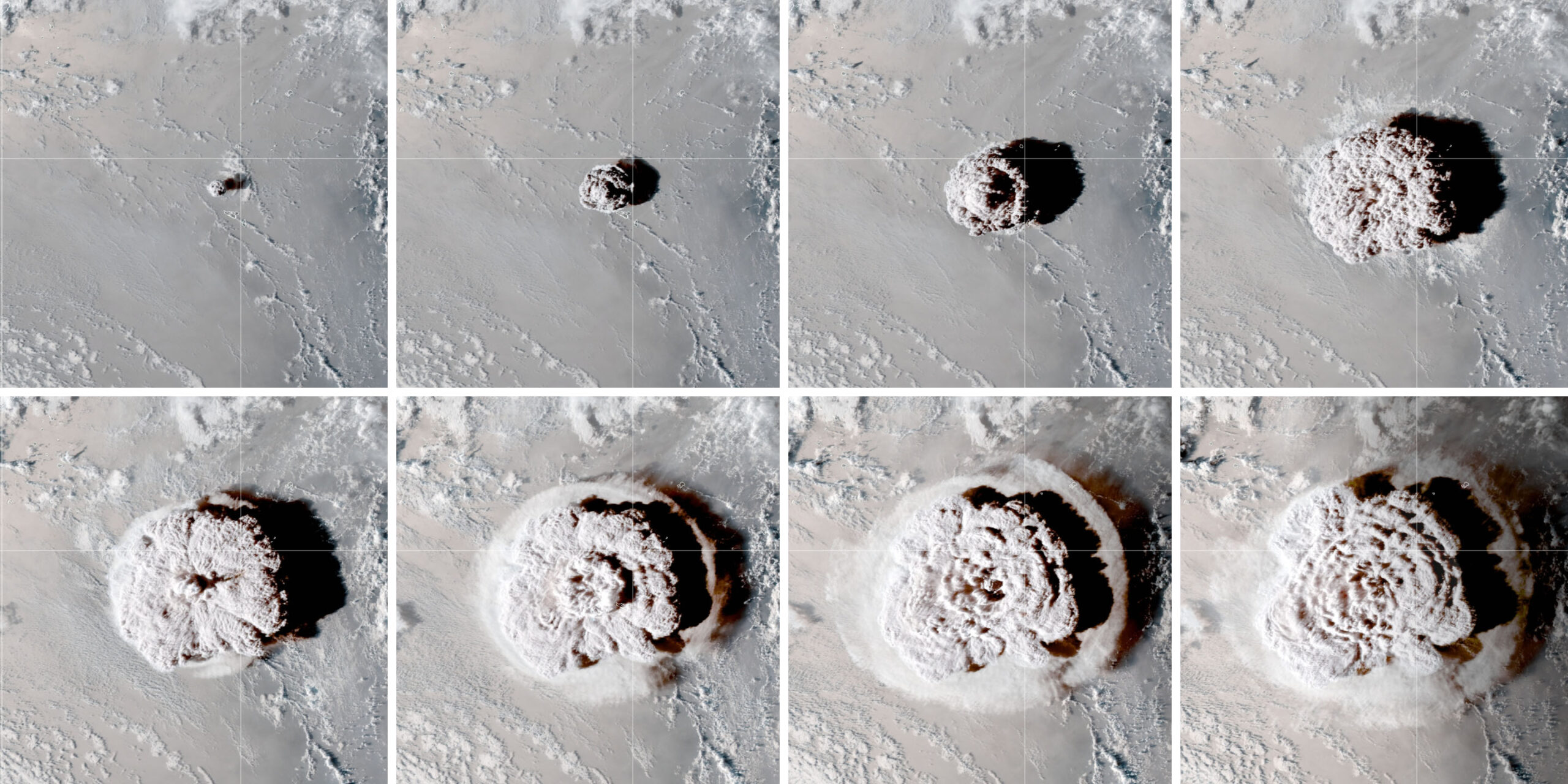

Hunga Tonga-Hunga Ha‘apai is a giant volcano under the South Pacific Ocean, 3,000km (1,860mi) east of Australia. The January 15, 2022, eruption of Hunga Tonga propelled a huge dome of water and volcanic ash up through the entire stratosphere and into the mesosphere where meteors burn up (Figure A ). It’s the highest eruption ever observed.

While Krakatoa and Pinatubo may have launched far more solids than Hunga Tonga, the altitude of Hunga Tonga’s eruption plume and its massive amount of water were the largest of any known eruption. If Krakatoa and Pinatubo were shotgun blasts, Hunga Tonga was a bullet.

I made hundreds of photos of twilights caused by the 1991 Pinatubo eruption, the second greatest of the 20th century. Figure B compares Pinatubo and Hunga Tonga sunsets and clearly reveals that the Pinatubo cloud was denser. Nevertheless, Hunga Tonga produced spectacular twilight glows around the world (Figure C
 ). On some days the Hunga Tonga aerosols surrounded the sun with a deep red glow (Figure
  D).
D).


The Hunga Tonga eruption increased the water vapor in the stratosphere by 5 to 10 percent. A prominent atmospheric scientist told me the excess would remain in the stratosphere for up to a decade. This is important, for water vapor is the chief greenhouse gas. Thus, adding water vapor to the stratosphere might slightly increase the Earth’s average temperature. It might also slightly reduce the stratospheric ozone layer.
Major volcano eruptions like Hunga Tonga also inject sulfur into the stratosphere, where it is transformed into microscopic droplets (aerosols) of sulfuric acid. The Hunga Tonga cloud contains far less sulfuric acid aerosols than Pinatubo’s. But there’s enough to cause spectacular orange and red twilights around the world.
LIDAR VS. PHOTOMETER
The Meinel method and the Krakatoa studies of 1888 provide credibility for the measurement of the height of the top of aerosol clouds. But how can we know the altitude of the densest bulge in Figure G is correct?
Lidars measure the altitude of aerosol layers by means of a powerful laser. In 2016, I compared one of my twilight photometers with the lidar at Hawaii’s Mauna Loa Observatory, which I was trained to operate by its developer, Dr. John Barnes. After data from six twilight sessions, the stratospheric aerosol layer in the data measured by the lidar and the photometer were compared. The average altitude differed by only 0.9km (2,953ft). This provides credibility for the altitude range in Figure G.
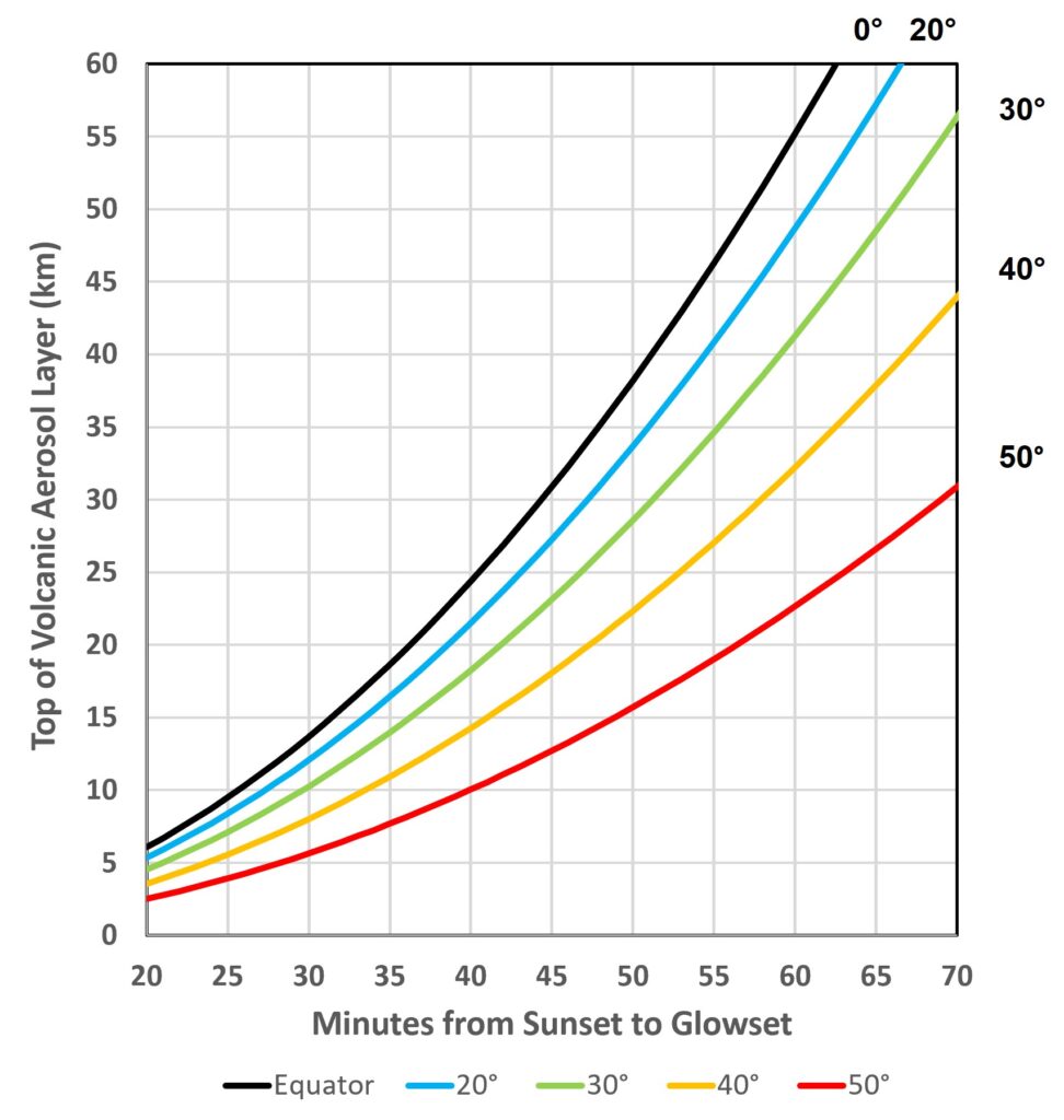
 E is a chart based on Meinel’s formulas that shows the altitude of the top of the volcanic aerosol layer for various latitudes and times from sunset to glowset.
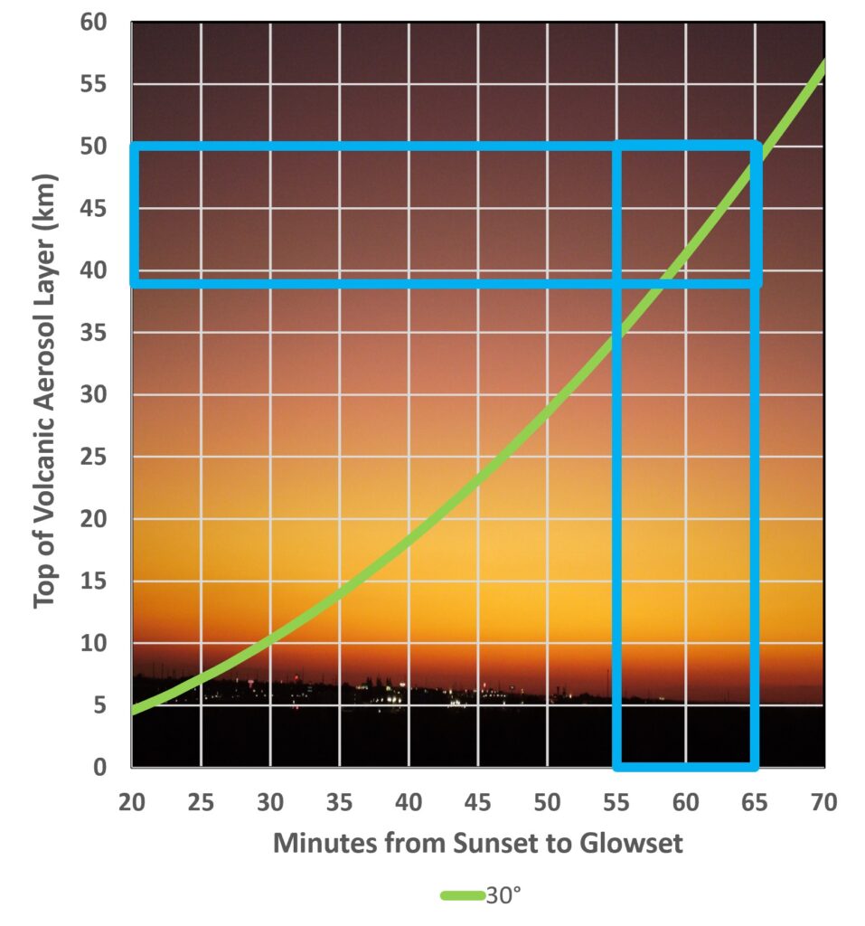
 shows typical Hunga Tonga twilight results at my site, which is just below a latitude of 30 degrees. The box in this chart shows the peak altitude range of the volcanic aerosol cloud over my site during November 2022. The Meinel method is influenced by distant clouds, mountains, and the altitude of your observing site, which should be added to the altitudes in the chart. If you’d like to make your own chart, you can get the complete Excel spreadsheet used for Figure E from
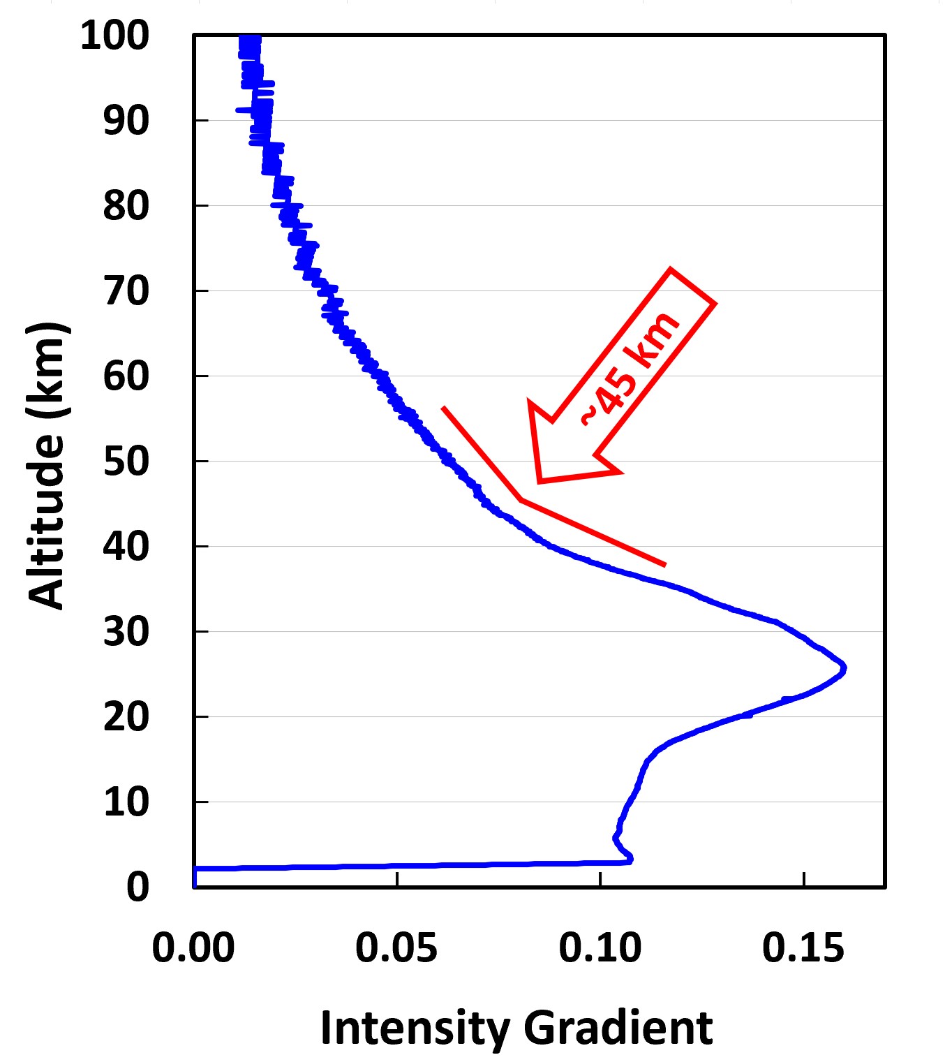
 shows an LED twilight photometer sky profile on November 6, 2022, from the surface to 50km (164,042ft). The profile shows that the densest region of the Hunga Tonga plume was at 25.8km. Figure
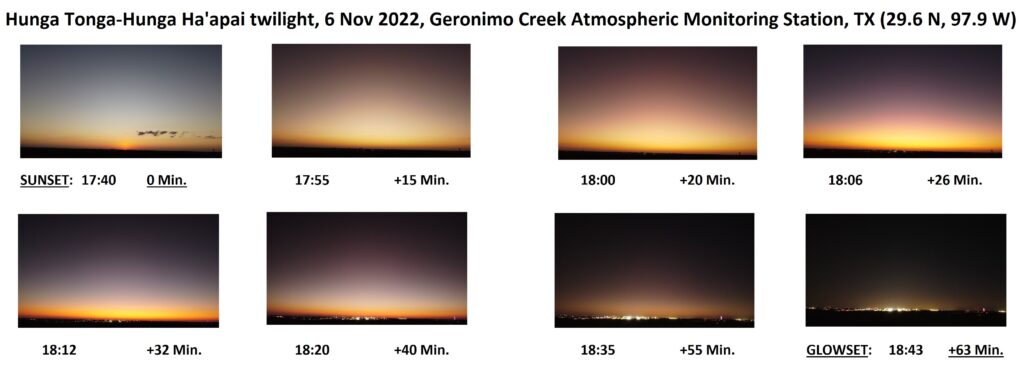
  H is a sequence of some of the twilight photos that evening. The sunset to glowset time (63 minutes) and the graph in Figure F show that the top of the plume still reached 46km (150,918ft) — over 28½ miles high — 10 months after the eruption.